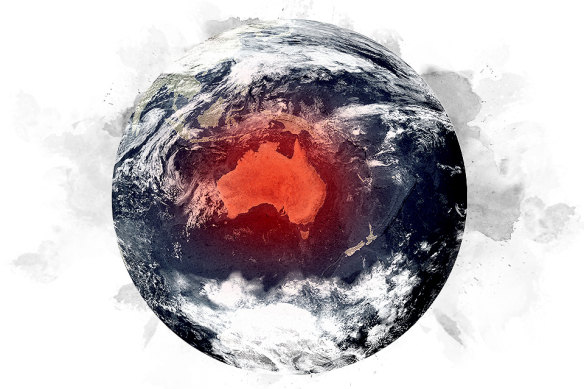
It’s official. An El Nino has been declared. What does that mean?
El Ninos are associated with heat and less rainfall. But what causes them? And what difference does climate change make?
Save articles for later
Add articles to your saved list and come back to them any time.
Once exotic terms used by farmers, meteorologists and weather nuts, El Nino and La Nina have crept into the lexicon as the world’s weather has become more extreme. They’re climate patterns that determine, broadly, whether we’ll have a hot or a wet summer – and whether we’re more likely to have a risk of bushfires, floods and droughts.
The world is, on balance, hotter during El Nino years. It’s more volatile too: studies have shown civil conflicts triggered by drought have happened mostly in El Nino years. Now, with climate change destabilising the atmosphere and ocean temperatures, El Ninos are entering uncharted waters.
How scientists predict an El Nino is a delicate dance of observations, including from some 3000 satellite-tracked buoys, moorings and underwater ocean gliders in the Pacific Ocean. The Bureau of Meteorology has now declared an El Nino event, the first called in Australia since 2015-16 and quite a change after the wet weather that has inundated us during La Nina events over the past three years.
So, how do you define an El Nino? And what difference does it make to us?
Credit: Artwork: Aresna Villanueva
What’s an El Nino?
An El Nino is an oceanic and atmospheric phenomenon that temporarily disrupts the status quo of the Pacific Ocean. The normally cold waters off South America warm up, causing more rain off its coast. The waters off Australia get colder, so there’s less moisture in the air, less average rainfall and a greater chance of hot temperatures and, potentially, fires.
El Ninos are part of a bigger climate pattern called the El Nino-Southern Oscillation (ENSO), which fluctuates between a neutral phase (when there is average rainfall in Australia), a La Nina phase and El Nino. El Ninos can last from six months to two years. Critical to the phases are the trade winds, which blow from east to west and which form the lower part of a huge loop of air that circulates over the Pacific called the Walker Circulation – it’s the black rectangle shown in the graphics below.
Here’s how the phases work.
During the neutral phase of ENSO, above, tropical warm air rises over the seas north of Australia and travels east, high in the atmosphere towards South America. The air sinks over colder east Pacific waters and skates back towards Australia along the surface of the ocean as trade winds, completing the Pacific Walker Circulation.
When these trade winds strengthen, more warm water piles up near Australia. Air is more likely to rise and create clouds and rain, which can translate into above-average rain in winter and spring for eastern Australia – and a more-active-than-normal tropical cyclone season.
During El Nino, the winds weaken or reverse and warm water collects off the coast of South America and throughout the central Pacific instead. The ocean waters are colder off Australia and less moisture rises into the atmosphere, leading to lower-than-average rainfall and possible drought.
The weather patterns were named in Peru by fishermen in the 1600s. Warmer currents off the coast of South America meant fish became scarce, off chasing nutrition-packed cold water; El Nino means “little boy”, named for “el nino Jesus” because the weather phenomenon peaked at Christmas. A La Nina (“little girl”) meant cooler water and fuller nets.
Indigenous farmers of the Andes mountains traditionally practised a particular method for predicting El Nino. In June, before dawn, they squinted at the 11-star Pleiades constellation just above the horizon. If the stars were crisp and bright, they could expect normal rainfall and planted their thirsty potato crops. If the stars were dim and fuzzy, they held off: high-altitude clouds in the atmosphere indicated an El Nino, dumping rain on the South American coast but not on them, at their higher altitude.
How do you predict an El Nino?
Official measures of El Nino events vary. The World Meteorological Organisation relies mainly on water temperature in the central-eastern equatorial Pacific to determine whether an El Nino is under way, while Australia’s Bureau of Meteorology relies more on atmospheric pressure and trade wind speed as well as marine temperatures.
Scientists divide the Pacific into sections. To predict an El Nino, they focus on a rectangular strip of waters straddling the International Date Line dubbed Nino 3.4 (see image above). They have four main criteria.
First, if water temperatures exceed a certain cool threshold in this strip of ocean for at least three months, a La Nina is declared; if the temperatures are warmer than usual, it’s El Nino time. It can also be neither or neutral.
Second, meteorologists also directly check the speed and direction of trade winds to see if they’re weakening.
Third is the Southern Oscillation Index, which puts the “SO” in ENSO and indicates the difference in pressure between Darwin and Tahiti. If the number is high, typical of La Nina years, pressure is lower in Darwin and higher in Tahiti, ushering rain and cyclones towards Australia. If the index number is negative, as it is in El Nino years, higher pressure in Darwin expels those rain-summoning clouds away from our shores.
Finally, the Bureau of Meteorology keeps track of seven climate models, which predict how much cooler or warmer ocean temperatures may be over the next six months.
What difference does it make to us on the ground?
El Nino has a profound influence on Australia’s climate, depleting rainfall and ramping up daytime heat, hence boosting the chance of risky bushfire seasons.
Nine of south-east Australia’s 10 driest winter-spring periods were during El Nino events. And most of the major droughts, including in 1982, 1994, 2002, 2006 and 2015, coincided with El Ninos, according to the Australian Research Council’s Centre of Excellence for Climate Extremes. In the weak-to-moderate El Nino of 2002 and 2003, a drought halved Australian wheat production. The winter crop yield fell by 40 per cent.
Days are hotter on average during El Nino years, especially in southern Australia, due to decreased cloud. In Australia’s north, there is a greater chance of multi-day heatwaves too. (In the south, high-pressure systems move around more during an El Nino, which actually reduces the chances of prolonged warm periods in cities such as Melbourne and Adelaide, even though overall average temperatures remain high.)
And the decrease in insulating cloud cover during El Ninos can mean colder nights, increasing the risk of frost, which can damage crops already weakened by less rainfall. The double-whammy of drought and frost reduces GDP from farms by 13 per cent on average during El Nino years, notes the ARC Centre of Excellence for Climate Extremes.
If the effects seem complicated, they are also unpredictable. El Nino events can vary in intensity. As CSIRO climate science centre research director Dr Jaci Brown puts it, “El Nino is Spanish for boy child and I think a good analogy is that although we know we’re getting a boy, every child can be different.” Brown says Australia and the Pacific Islands feel the effects more than other countries because of our exposure to the Pacific Ocean, where the warming trends occur.
Also in the mix is ENSO’s western cousin, the Indian Ocean Dipole, which has a “positive” phase with similar effects to El Nino across southern and eastern Australia. The bureau has also called a positive IOD after models predicted for months that the system would probably develop in spring.
New research by Australian climate scientists suggests double or triple runs of La Nina and El Nino years have become more common since the industrial era. Some model projections also suggest extreme El Ninos will double in frequency from one in 20 years to once every decade by the end of this century.
The backdrop to all of this is, of course, climate change. “Climate change puts a layer on top of what we see in El Nino and La Nina years,” says Brown. “We’ve always had periods of more intense and less intense years – that’s just natural variability – but we don’t yet understand how climate change will impact this because we are moving into a climate regime we’ve not seen before. This is a whole new world under climate change.”
Sign up to get our Explainer newsletter here: fascinating answers to perplexing questions delivered to your inbox every Sunday night.
If you'd like some expert background on an issue or a news event, drop us a line at [email protected] or [email protected]. Read more explainers here.
Most Viewed in National
Source: Read Full Article


